
Lebanon ZIP Code Directory Coverage
Two ZIP codes are verified as serving City of Lebanon addresses: 17042 and 17046. Both appear in the USPS Lebanon grouping, and both occur on City-labeled parcels in the County data. The useful question is not which half of town belongs to one code. A postal code must be checked against the exact delivery address, because the same City ward can contain addresses using either one.
| ZIP | Local evidence | Postal use | Record-search note |
|---|---|---|---|
| 17042 | County Municipal Building and City Hall use this code; City-labeled parcels appear in Wards 1, 2, 3, 4, 7, 8 and 9. | USPS lists it in the Lebanon, PA grouping. | Confirm the address, then use the parcel map for the municipality. |
| 17046 | Official City addresses also use this code; City-labeled parcels appear in Wards 3, 4, 5, 6, 7, 9 and 10. | USPS lists it in the same Lebanon, PA grouping. | Its overlap with 17042 proves a ZIP is not a ward boundary. |
The County snapshot counted 3,862 City-labeled parcels with a 17042 situs ZIP and 4,801 with 17046. Those are parcel-data observations from August 31, 2026, not resident or voter counts. They make one point clearly: the ZIP code directory works at the address level, not as a way to divide Lebanon into fixed postal neighborhoods.
Other Lebanon County-area codes, including 17003, 17022, 17067, and 17078, are associated with Annville, Cleona, Myerstown, and Palmyra in the County research. They are not evidence of City of Lebanon delivery coverage. A Lebanon mailing label should therefore be checked through USPS and then through the parcel municipality before a City office receives a records request.
Lebanon ZIP Codes Cross City Wards
Wards 3, 4, 7, and 9 have City-labeled parcels carrying both verified ZIPs. A postal city label can also extend beyond the City boundary toward nearby municipalities. That is why a records request cannot be routed from the word “Lebanon” on an envelope alone. Check the parcel’s municipality before choosing City Building and Zoning, a township office, or a County department.
Lebanon County GIS directs users to the County Property Viewer and local map resources. The screenshot below shows the County GIS starting point, where the viewer, E911 guidance, and data-request channels are collected.
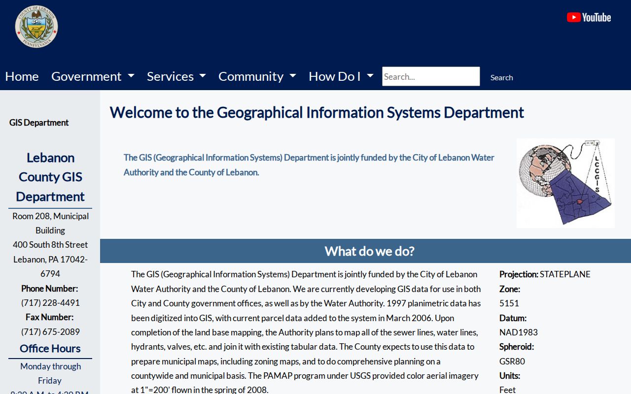
Use that County route after USPS confirms delivery geography. The parcel popup, rather than the ZIP alone, supplies the site address and municipality that determine the correct local records path.
Note: Postal routing, City limits, wards, precincts, and parcel boundaries answer different questions and should be recorded separately.
Verify a Lebanon ZIP Code First
USPS ZIP Code Lookup offers ZIP by Address, ZIP by City and State, and Cities by ZIP. The address route asks for a street address, with company and apartment or suite fields available when relevant. The city-and-state route requires both fields, while the reverse route starts with a ZIP. USPS warns that a returned ZIP does not confirm that a particular person or company is at the address.
| USPS mode | Input captured | Best Lebanon use |
|---|---|---|
| ZIP by Address | Street address required; company and unit optional. | Confirm the delivery code before a parcel search. |
| ZIP by City and State | City and state required. | Check the postal grouping, not a specific property. |
| Cities by ZIP | ZIP required. | See USPS city naming for a known code. |
The USPS screen in the image is a postal-verification tool, not a residents list. Its answer should be written down with the full address before moving to County GIS.
The official USPS lookup is shown below. Its three search modes keep a request anchored to mailing geography before County records establish property or government jurisdiction.
A confirmed code can prevent a bad address string, but it cannot replace the County viewer’s address or map-number search.
For a Lebanon address with a unit number, keep the unit in the USPS check and preserve it when asking a custodian for an existing file. A ZIP result only confirms the postal portion of the address. It does not decide whether the parcel belongs to Lebanon City, one of the neighboring townships, or a particular election district.
Find Lebanon Records After ZIP
There is no published County search that returns a ZIP-wide property roll, and the Property Viewer does not offer a public ZIP filter. The statewide voter-status service is also a self-status and polling-place tool, not a ZIP directory. A ZIP narrows an address question; it does not create a list of residents. Once an exact address is verified, the County’s address or map-number route is the proper next step.
- Confirm the full delivery address with USPS and retain the returned ZIP exactly as shown.
- Search the County Property Viewer by site address or map number, not by ZIP alone.
- Record the map number, UPI, parcel municipality, and deed book or page where the popup shows them.
- Ask Assessment about owner-of-record context, then use the Recorder for a documented title question.
- For an old address, switch to a dated directory or map source instead of applying modern ZIP geography backward.
The Lebanon street address directory takes over once the ZIP has narrowed the search to a particular street and parcel. It explains the address-to-UPI-to-deed chain without pretending the ZIP itself identifies a household.
Lebanon Parcel Fields After a ZIP
A valid postal address becomes more useful when it is tied to the County’s own identifiers. The Property Viewer accepts an address or map number. Its public layer is address keyed, with partial matching and a limited result list, not a broad postal-area browser. The configured parcel popup can show a site address, owner mailing address, municipality, school district, deed book and page, acreage, assessments, sale date, and sale price.
Keep the field meanings apart. The site or situs address marks the physical parcel. An owner mailing address is a correspondence location and can be elsewhere. A map number, GeoPin, or UPI is the local bridge between GIS, Assessment, and Recorder records. A legal description in a deed controls a property description when an approximate tax-map line and an older street format do not match.
Lebanon ZIP Searches Have Limits
The County’s viewer supports address, map-number, manufactured-home-address, and geocoder paths. Its public configuration does not provide a ZIP-wide owner or resident browse. A voter list is separately controlled by the Pennsylvania Election Code: the personal status lookup is not a public street roster, and the regulated list request requires identification, a signed use statement, and a $20 county selection. Those boundaries matter when a question begins with only a postal code.
A property record may identify a current owner of record and mailing address. It does not prove who occupies every unit, and it should not be used to infer renters, household members, protected addresses, or delivery customers. For a defined City permit, zoning, or code file, the alternate route is a narrow written request to the City Open Records Officer, not a ZIP-wide request for names.
Use addresses lawfully. Lebanon records can support a defined property or family-history question, but never surveillance, intimidation, harassment, or an attempt to defeat an address-protection program.
Lebanon ZIP Code Geography and City Limits
A Lebanon ZIP code directory should never treat a postal answer as proof of City jurisdiction. The City zoning map is adjacent to North Lebanon, South Lebanon, North Cornwall, and West Lebanon Townships. An address can use “Lebanon, PA” for mail while a different municipal office keeps the permit or zoning file. County GIS supplies a parcel municipality; USPS supplies a delivery code. Both facts are needed before sending a request.
- ZIP and ZIP+4
- A ZIP identifies a delivery area; ZIP+4 narrows a delivery segment. Neither is a parcel boundary or proof of a current resident.
- P.O. box ZIP
- A postal code can serve boxes rather than physical delivery addresses. It should not be treated as a place of residence.
- Unique ZIP
- A code can be assigned for a particular organization or large mail recipient. The research did not verify one for Lebanon City.
- Carrier route
- A delivery route used to sort mail. It is not a City ward, precinct, or legal property description.
Lebanon E911 Address Form
County E911 guidance helps clean up an address before it reaches USPS or GIS. It uses a number, any predirectional, road name, suffix, postdirectional, and then a unit where needed. The guide generally avoids new fractional, alphabetic, or hyphenated primary numbers and says road numbers normally rise from an origin, with odd and even sides arranged by direction. These are local addressing conventions, not a claim that every historic City address was always formatted the same way.
Historic work requires a second check. City Council minutes record a 2021 change to a Walnut Street segment west of Edison Street to North Tenth Street, but the reviewed source does not establish the replacement name. Search the older wording as printed, then compare the current GIS record and the Recorder legal description before deciding the address disappeared.
Lebanon History Predates ZIP Codes
Modern ZIP codes do not organize older Lebanon evidence. For a historic address, the Lebanon County Historical Society has comprehensive City cross-reference directories that can supply an owner-or-tenant clue for a stated year, although it cautions that outlying areas are not all covered. The Library of Congress digitized Lebanon telephone directories from 1940 through 1948, and its broader reel reaches 1957. Those listings are dated subscriber clues, not legal title or a current household record.
For a still older location, the 1896 17-sheet Lebanon Sanborn map offers building and street context. Pair it with the parcel’s legal description, the Recorder’s deed path, or the Historical Society’s deed-index microfilm rather than trying to translate a current ZIP into a nineteenth-century boundary.